Friends, in the archaeology community, I need to hear your points of view.
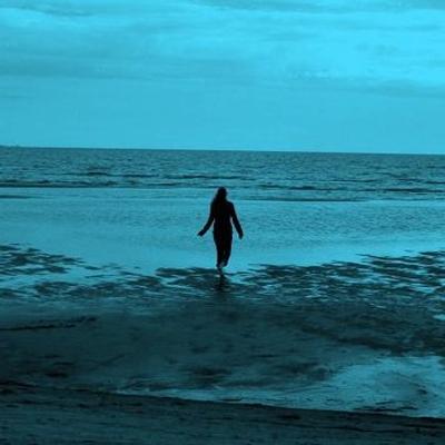
How did the European Vole get from mainland Europe to Orkney without passing through Britain and becoming the Orkney Vole?
This subject is a little complicated, so please bear with me.
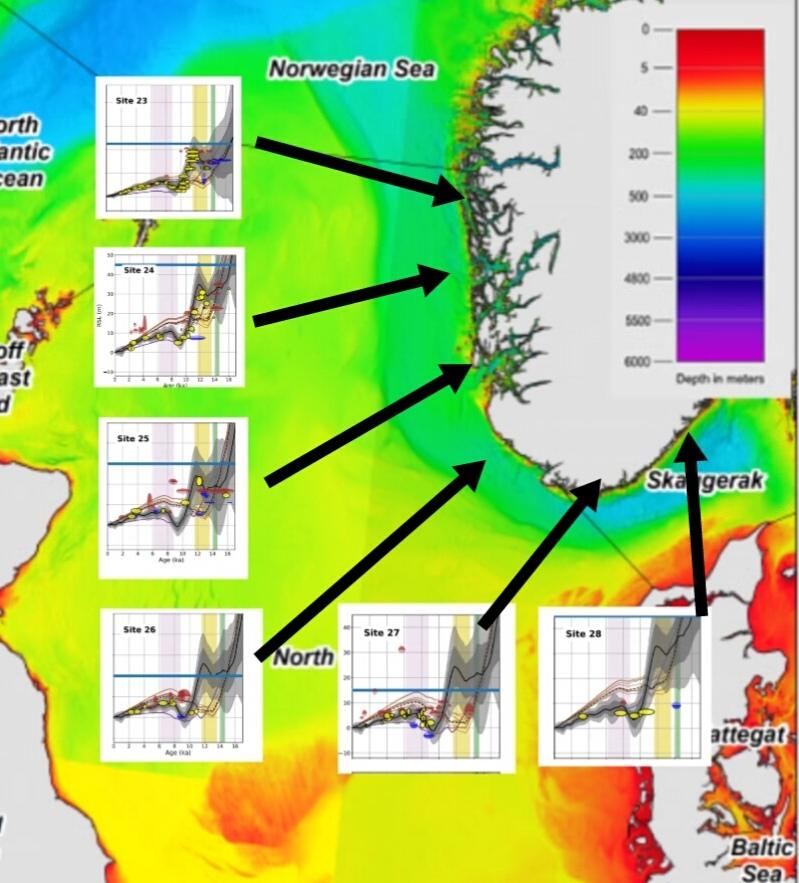
The map here shows the coast of southern Norway as it faces the Norwegian Channel and the North Sea.
The charts on it represent the change in sea level in the last 18,000 years at the specified locations.
As there were a couple of kilometres of ice on Norway in the last ice age, the land there was firmly held down, and compressed into the earths mantle. When the ice melted the land rose up again, and that rising up is what is depicted in the charts.
Along this coast though, there is a marked pulse of sea-level rise that breaks the smooth fall of the graph.
This is an uptick in the graphs that peaks at 12,000BP, a time when huge amounts of water and ice were flushing off the melting Norwegian ice sheet.
The height of the surge above local sea level, as you can see on the graphs, is around 10 metres, and local sea-level was about 60 metres below present levels. Therefore, the surge peaks at 50 metres below present sea-level.
The location of the surge is limited to the North Sea facing coastline, with hints of it along the Atlantic coast, but none at the North of Norway.
As this is caused by glacial runoff, there are two possibilities here. Firstly that the surge of high water against the coast of Norway represented a rise in sea level across the whole North Sea, in which case, Wow!
Secondly , that the surge of meltwater was contained between the walls of the Norwegian Channel.
In this case, then there must have been land at the west bank of the Norwegian Channel, opposite Norway, at less than 50 metres below our present sea level.
Currently the west bank of the Norwegian Channel is over a hundred metres below sea-level, meaning that at least 50 metres depth of sediments has been lost from the floor of the North Sea.
Does this mean that Doggerland, far from being limited to the Dogger Bank, actually extended North towards Shetland, along the west coast of the Norwegian Channel?
Might it also mean that this was the route that the European Vole took to walk from Europe to Orkney, where it became the Orkney Vole (Cucchi, Analyses of the remains)


, ancient Celtic work-spells.
She was never free like the lipsticked shop-girls
On Thursday afternoon; all her tasks
Were like bluebells in a jar on the window-sill.
On Friday she rose above textures of oat and barley
Into the paradise of cakes.
I licked cream from the wooden spoon.
Saturday night, I followed her basket and purse.
The grocer, silver-spectacled, was king
Of the apples, cheeses, syrup, sweetie-jars, cloves.
We sat, seven, in the high pew on Sunday.
After the psalms, her paper poke
Made sweet thunders all through the sermon.")