med-mastodon.com is one of the many independent Mastodon servers you can use to participate in the fediverse.
Medical community on Mastodon

Administered by:

Server stats:

415
active users

#monolake

0 posts0 participants0 posts today

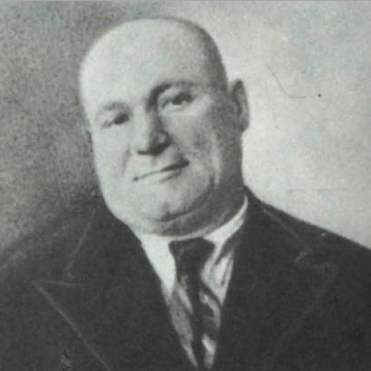
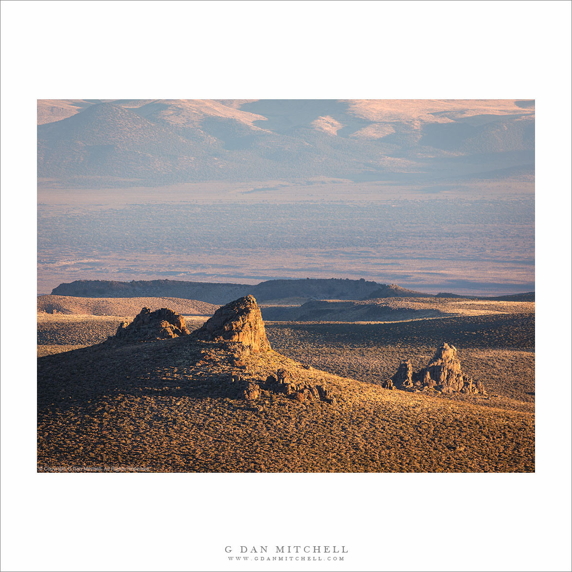
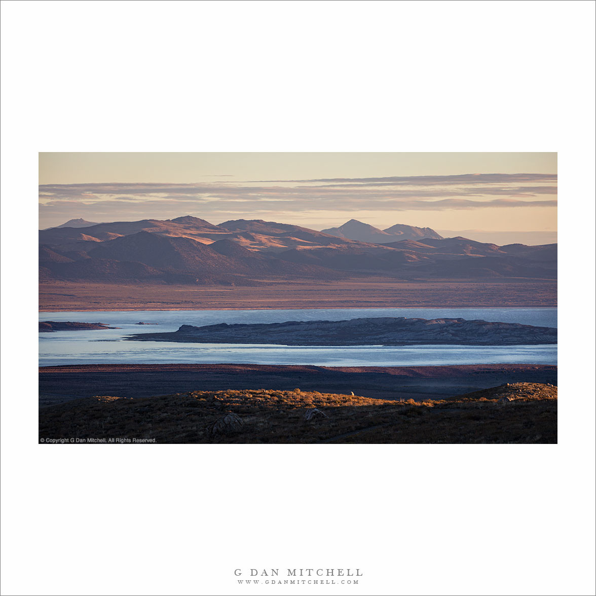
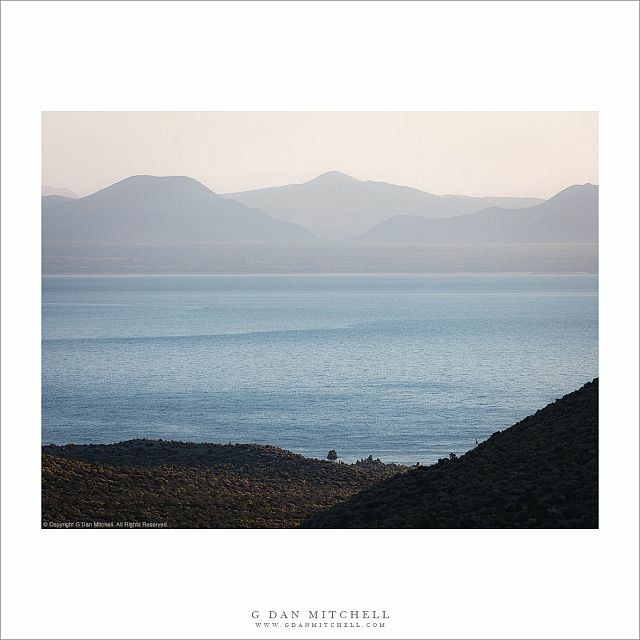
Today in Labor History March 12, 1928: The St. Francis Dam failed in Los Angeles, California, killing 431 people. It is the second deadliest disaster in California, after the 1906 earthquake, and one of the worst U.S. civil engineering disasters ever. A defective foundation and design flaws caused the failure. Yet, the inquest absolved chief engineer, William Mulholland, of all criminal responsibility, and he continued to earn a salary from the Bureau of Public Works (though his career was effectively ended). The authorities continued to find the remains of victims of the flood until the mid-1950s. Many of the victims were washed out to sea. Some washed ashore as far south as Mexico. Mulholland was also the designer of the 233-mile Los Angeles Aqueduct, which sucks water from the Owens Valley and is a major cause of the depletion of the fragile Mono Lake. As its water levels continues to decline, it threatens the world’s second largest gull rookery, home to up to 50,000 birds. The aqueduct’s construction, and the shady methods Mulholland used to acquire the water rights, led to the California Water Wars between L.A. County and Owens Valley farmers. Many of those same Anglo farmers (or their predecessors) usurped the land from Piute people during the 1863 Owens Valley Indian War, which was precipitated, in part, by the vast loss of human and cattle lives, and the displacements, caused by the Megaflood of 1861, which inundated much of the West, from Idaho and Oregon, down to northern Baja California. The corruption related to the construction of the aqueduct has been portrayed in the film Chinatown, and in the nonfiction book, “Cadillac Desert.”

For more on the Megaflood of 1861, please read my article, “Worse Than the Big One”: michaeldunnauthor.com/2023/01/

#workingclass #LaborHistory #flood #dam #mulholland #monolake #owensvalley #disaster #nativeamerican #indigenous #piute #ecology #chinatown #indianwar #habitatdestruction #books #nonfiction #author #writer #losangeles @bookstadon

#WaterIsLife #MonoLake

"The Eastern Sierra lake has provided water to Los Angeles since 1941, when DWP began diverting its tributaries to city taps.

Known for its unique tufa rock towers, migratory birds and stunning Sierra Nevada backdrop, the salty lake has been the focus of environmental battles for more than 80 years between the city, conservationists and the local Kutzadika’a tribe.

Mono Lake’s surface levels have plunged over the decades because of the city’s aqueduct, hitting historic lows in the 1980s and increasing the lake’s salinity, which jeopardizes the tiny shrimp that are the major source of food for birds.

In July, the lake, rising from excessive snowmelt, hit its highest level in 17 years but is now dropping. A state goal set in 1994 aims to restore the surface to an elevation of 6,392 feet — a target that is currently 9 feet away"

danvillesanramon.com/calmatter

Danville San Ramon · Another casualty of a bone-dry winter: LA won’t take less water from Mono LakeBy CalMatters

“Mono Lake, Morning” — Pahoa and Negit islands silhouetted against early morning lake reflections with desert mountains.

I have shared a few other Mono Lake photos made at this elevated location some distance from the lake. This camera position gives a different and broader sense of the lake and its surroundings. It is a huge body of water — there’s far more water on the far side of the islands than between them and the near shore. The desert mountains are many miles beyond the far edge of the lake. All in all, Mono Basin is a place of immense space and great distances…continues: gdanmitchell.com/2024/12/31/mo

“Burned Pines, Mono Basin” — Burned trees near the end of a giant pine forest, Mono Basin.
This desolate scene is along the fringes of Mono Basin, the large valley holding Mono Lake. It is just east of the Sierra Nevada, but it is a very “un-Sierra-like” place, being dry sagebrush country for the most part. The photograph looks past a sparse forest of dead snags and in the direction of Mono Lake itself…continues: gdanmitchell.com/2024/12/27/bu

“Sunset Storm, Mono Lake” — An evening storm moves over Mono Lake at sunset.

Occasionally nature throws some light at me that seems just plain unreal — effects so unusual that even I start to doubt what I saw. Often this happens at sunset or sunrise when the conditions align just right, as they did on this evening. It had been cloudy and raining, and there was still moisture in the air as the clouds began to break up in the north and west. As that happened, colorful sunset light came in over the Sierra crest and illuminated the clouds from within…continues: gdanmitchell.com/2024/12/21/su

“Ponderosa Pines, Mono Lake” — A few ponderosa pines near the shore of Mono Lake.

I reached this spot on a lonely gravel road that branched off from the main route heading southeast from Mono Lake toward some slightly higher sections of the basin. This group of ponderosa pines includes the last trees that manage to grow here, and beyond this point it was all dry sagebrush country. In the distance you can make out Mono Lake and distant mountains beyond its far shore…continues: gdanmitchell.com/2024/12/15/po

“Mono Basin Sentinels” — Rock towers in morning light on high desert hills above Mono Basin.

Mono Lake is immense, but it is dwarfed by the full extent of Mono Basin, the large valley it occupies. Prehistoric Mono Lake was much larger and deep enough to leave water marks along the base of mountains that are today quite dry. To get an idea of the full extent of the basin you must either travel around it (and learn how long it can take) or find a high place from which the whole thing is visible…continues: gdanmitchell.com/2024/12/07/mo

“Negit Island, Mono Lake” — Tufa formations along the shoreline of Mono Lake with Negit Island in the distance.

In a recent Mono Lake post I mused about finding and photographing less familiar views of this magnificent place. But I also mentioned that sometimes I do stop and photograph the well-known locations when the opportunity arises. With that in mind, I acknowledge that this photograph was made at one of the familiar places along the western shore of the lake. Heck, there’s even a place there to pull in, pay a fee, have a picnic, and take a hike!…continues: gdanmitchell.com/2024/12/03/ne

“Mono Lake, Mountains, Morning” — Early morning autumn light on Mono Lake and distant desert mountains.

Part of the challenge of photographing a familiar subject is finding a different perspective on it. This is especially true with “iconic” subjects that everyone has seen, and which we know by way of familiar views. If you think about any famous place you can probably visualize the scenes I’m thinking of — familiar views of familiar things. (I’m not against them. In fact, it is an interesting challenge to try to make those views different.) There are several familiar approaches to photographing Mono Lake. Yes, I’ve done them, too!…continues: gdanmitchell.com/2024/11/28/mo

“First Light, Mono Lake” — Colorful dawn light over Mono Lake just before the rising sun clears the mountains.

Arising for dawn is a challenge for many people. I understand, but I think the rewards earned by getting up early are worth it — though I do have to remind myself or this sometimes as I contemplate my alarm going off a few hours before sunrise. But once I’m up and on my way, I actually enjoy the entire experience — the pre-dawn travel in darkness, the first glow in the eastern sky, the anticipation as the light builds, the first direct light on peaks, and eventually the sun itself. If you can’t imagine getting up that early, just try it a few times. I suspect you might get hooked…continues: gdanmitchell.com/2024/11/24/fi

“Mono Lake Shoreline, Morning” — The Mono Craters rise beyond the shoreline of Mono Lake on an autumn morning.

Sierra Nevada autumn photographs often feature the colorful leaves of aspen trees, but this is what fall looks like at the base of the eastern escarpment of the range. The grasses have turned golden brown, there’s often a bit of haze in the air, and things seem to be quieting and slowing as the seasons change. I made the photograph on a fall color trip to the Sierra, but I also ended up spending a lot of time in spots like this…continues: gdanmitchell.com/2024/11/16/mo

“Mono Shoreline, Dawn” — Dawn at Mono Lake near Black Point.

At some point on virtually every visit to the Eastern Sierra I end up photographing at Mono Lake… again. I’ve photographed the place for decades, but I still find new ways to see it on almost every visit. This time I headed to the northwest ‘corner” of the lake to watch the sun rise, and I got lucky with the beautiful sky colors and their reflection on the water…continues: gdanmitchell.com/2024/11/12/mo

“Morning Haze, Mono Lake” — Morning haze mutes details of distant desert mountains beyond Mono Lake.

A photograph can be viewed in more than one way. The default is to regard it as an objective record of the subject — a “capture” of what was there when the exposure was made. But photographs are not really objectively accurate, and it might be better to think of them as expressions of how the photographer views and wants you to view the subject. This takes us to yet another possibility — that beyond the literal content of the photograph, we can also view it as a sort of abstraction, a composition of shapes and colors and densities, and textures. In the end, it can be all of these at once, and more…continues: gdanmitchell.com/2024/11/08/mo

“Black Point, Mono Lake, Evening” — Evening clouds above Mono Lake and Black Point.

I made this photograph on an autumn evening after incoming clouds had ended my aspen photography for the day. I decided to make a quick run down to the shoreline of Mono Lake to see if there might be any interesting dusk light. The conditions were a bit subtle, but I think that they are actually representative of what we’re likely to see at Mono in the evening when clouds over the Great Basin dissipate and the lake is in shadow…continues: gdanmitchell.com/2024/11/04/bl

#monolake #evening #sunset #nature #landscape #photography

“Mono Lake, Before Dawn” — Colorful pre-dawn clouds over Mono Lake.

This photograph may look very similar to a previously shared Mono Lake photo — both feature the reflecting surface of the lake and a colorful sky. But they are quite different images, photographed from very different places and at different times of the day. The other one was from an evening when afternoon thunderstorm clouds were dissipating. This one is from just before dawn on a hazy morning with high clouds illuminated by the colorful pre-dawn sky…continues: gdanmitchell.com/2024/11/02/mo

“Mono Lake, Dissipating Storm” — An evening thunderstorm dissipates above Mono Lake on an autumn evening.

It is well understood that some of the most interesting landscape photography light comes at the edges of the day, around sunrise or sunset. When things work out just right, Sierra Nevada weather conditions amplify this light. During the summer months...continues: gdanmitchell.com/2024/10/24/mo

Took a random, wandering hike up the back side of Black Point, a volcanic geological formation next to Mono Lake. Stumbled across some cool slot canyons. When I drove around to the regular Black Point trailhead parking area, the info kiosk had a vague sign explaining how to find them. There are cool calcium deposits on the sides of some of them and I decided I needed a new profile picture.

I think I may stay here till dark and see if I can get some Milky Way photos over the lake before the moon comes up.